. . . My friend, the irresistible and ever jubilant Cathy Guthrie.
Cargile Branch, Madison County, NC 2011.

Cargile Branch, Madison County, NC 2011.
Paw Paw Creek, at Anderson Branch, 030916
One of my walks last week yielded a bounty - a mini fridge, a shop vac and TV, a clothes dryer, bedsprings, and should you be hungry, a rotting goat. It's easy to be angry at this wanton disregard for our environment and the accompanying belief that the land is big enough to absorb whatever we throw at it. And I am, angry.
Paw Paw Creek, at Anderson Branch 030916
Anderson Branch Road, 030916
Upper Paw Paw, 030916
But I also remember a time many years ago when I first started hanging out with Dellie Norton. This one particular day we went to visit one of her relatives - a short drive and longer walk into a deep holler, following a boldly flowing creek. A small, broad valley with a patch of waist-high tobacco alongside a significant garden, a log cabin with wrap-around porch and smoke rising from the chimney - it couldn't have been more idyllic. We forded the creek, stepping gingerly on wobbly rocks and there we came face to face with the household dump site - an enormous pile of milk jugs, disposable diapers, tin cans, clothes, tires, and appliances - all spilling from the road and into the creek.
The very idea of trash was a relatively new concept for people like Dellie. Her's was not a throw-away culture. Use and reuse was what she lived by. But the arrival of modern culture to the mountains brought plastic, more packaging, and more waste. The thought of hauling it to a landfill and paying money to throw it away made no sense when it could simply be thrown in the creek where the next heavy rain would wash it from sight.
Upper Paw Paw, 030916
Upper Paw Paw, 030916
Now, some forty years later, I want to believe people surely know better, that we've learned that plastic and electronics don't simply vanish in the soil, that tires don't recycle in creeks. But evidence from my walks says, "no, we've learned nothing." Makes we wonder if it's not my anger that's misplaced.
That I should think instead of A Boxspring's Memory. Bits of cloth, cotton stuffing, invoices, a pair of intact panty hose, lacking only a good washing. And stories. Stories from the boxspring itself, of bouncing and creaking, of rust and decay. And stories from the owners of such things - My life with Boxsprings. And maybe from the imaginations and memories of people who see these pictures. It's what pictures do.
Cedric Chatterley, Sioux Falls, SD 2015
If any of you happen to be in Sioux Falls, SD, or anywhere remotely close, in the next month this is absolutely the exhibit to see. Cedric is a good buddy, but in my mind he is one of the premier social documentary photographers working today. Additionally, his handmade, large format cameras are works of art. To my knowledge, he is the only person in the country making these cameras. Cedric's work will be housed at the Rubenstein Rare Books and Manuscript Room at Duke University and he usually stops at our house on his frequent trips to North Carolina. Often, we get the first look at his new cameras - a 4x5 mounted in a horse's skull, another inside of a squeeze box, another an ode to the blues musician Honeyboy Edwards. This will be a significant exhibit by a most significant artist.
AUGUSTANA PERFORMING AND VISUAL ARTS PRESENTS:
'Reciprocity: Handmade Cameras and Photographs by Cedric Chatterley'
Event Details
The Eide/Dalrymple Gallery's latest exhibit, "Reciprocity: Handmade Cameras and Photographs by Cedric Chatterley" will be on display from Thursday, March 11, toSaturday, April 23. A gallery reception is scheduled for 7-9 p.m., Friday, March 11, with the artist's talk set to begin at 7:30 p.m. Gallery hours are 10 a.m. to 5 p.m.Monday through Friday; 1 - 4 p.m. on Saturday
Sculptural handmade cameras and photographs by Sioux Falls artist Cedric Chatterley are featured in this exhibition. Chatterley began his career in photography in the late 1980s, simultaneously working on long-term personal documentary projects and also as a hired photographer documenting traditional artists, musicians and craftspeople for various state arts agencies throughout the United States.
In 2006, Chatterley began building his own large format cameras, utilizing his advanced skills in welding and woodworking. He found that the traditional artists he had been documenting over the decades influenced him profoundly, and he began to ask various artists and friends to collaborate with him in producing sculptural cameras that he would then use to take photographs. This exhibition will display — for the first time — 17 of Chatterley’s cameras and 50 photographs.
We look forward to having you join us on Friday!
PawPaw, Madison County, NC 2016
Martin, South Dakota 2015
Anderson Branch, Madison County, NC 2016
I just want to give a big shout out thank you to the asshole who tossed these two TVs off the side of the road on Anderson Branch. Now, should I get bored on my walk, I can stop and imagine the inanity I could be watching if I only had a half-mile long extension cord with me. Throw your shit in your own backyard, or better yet, the landfill, but not in mine.
PawPaw, Madison County, NC 2015
Upper PawPaw Road, 01 30 16
Seven days post storm, 57 degrees today, 60 tomorrow and patches of our road are still slicker than bat shit, which, I might add, is closely related to bat shit crazy.
Kate and Rob, PawPaw, Madison County, NC 1993
Change abounds and I expect to alter the pace of my blogging. Not quitting, mind you, but definitely slowing for the time being. I'll leave you for now with this photograph of Kate and me. I carried this print with me on my trip, tucked in my notebook, where I could find it and look at it when I wanted, or needed.
Highway 60, West Texas
I leave Chaco buoyant, my clarity matching the crisp and bright of northern New Mexico. As Charley predicted, Chaco Canyon has been the perfect end point for this trip of mine, offering simplicity and reflection, even if just for a day. I sense I'm back where I started forty-odd years ago - leaving the Southwest; starting a new chapter; the same, but now accepted, mix of confidence and anxiety; heading to the same place, one I've called home for forty-two years. I know the task ahead - three long days of driving. It will not be slow. But it's time to be there.
I have one last visit to make, this one with Bill Tydeman and his family in Lubbock, Texas. Bill is an archivist with the library at Texas Tech University. When I first met him, he was the librarian at Mars Hill College in Madison County and had ideas of starting a photo archives that would focus on work from the mountain region of North Carolina. He began buying images from my Madison County work and later hired me to administer the archive. Bill, more than any one person, got me started and gave me confidence that my photographs had lasting value. It's important for me to see him.
West Texas
West Texas
Rest Area, Interstate 27, north of Lubbock
I'm not sure where, or why, I get off track, but somewhere in west Texas I miss a turn and it takes a while before I realize I've added 100 miles to my trip to Lubbock. I didn't want to be driving after dark, but I will be. I get to town late and in this very-easy-to-navigate place, with Bill's wife Leslie guiding me, I can't find their house. I'm confused, with no sense of direction, and when I find myself going the wrong way on a highway entrance ramp, I know I'm in trouble. I pull over and think slow, I think of this morning's raven, and it dawns on me I haven't eaten in a long while. My blood sugar.
Change is often hard to accept and much of my trip has been an effort to do just that, to surrender to time's passage. My friend is dealing with similar issues that for him are being played out with health problems, changes at work, a young wife and far younger son. But he's still doing vital work with a series of environmental writers and photographers, including authors Barry Lopez and John Lane. Our time together is the same as it has always been - talking, looking at photographs, exchanging ideas, encouraging. But the time is also different, changed as we both have aged, transitioning, opening new chapters. It's disquieting, but I leave with a phrase that's new to me, critical regionalism.
Bill Tydeman with Leslie, Brannen, and Asher, Lubbock, Texas
Highway 82, West Texas
The next two days will be a gut check - about 650 miles a day, much of it on I-40, a trucker's paradise, a small car's nightmare. The first part of the day is a flat glide through small-town Texas - Guthrie, Benjamin, Vera, Seymour - like I'm passing through lives of people I know. And the land itself, dormant now, and brown, bracing for wind and snow and ice, and soon enough, Texas heat. The sky remains open, big, the far-as-the-eye-can-see horizon. I stop to piss and eat the leftovers of last night's ribs and brisket. It's an interstate exit, a crossing road and empty field, nothing more. The road to Geronimo.
Lily Thomas Field, near Geronimo, Oklahoma
West Texas
I'm thankful to get off of the interstate at Newport, 435 miles in Tennessee this afternoon, an hour to go. It's well after dark, but I know the road home all too well. I see my first Confederate battle flag in six weeks. Hwy. 25-70 east is quiet, empty really, and I see no cars until I get to Hot Springs. It's not a warm night, but I open the windows to breath the mountains. I turn on Waylon Jennings singing a Billy Joe Shaver song, Willy the Wandering Gypsy and Me. And the resinous line: "Willy, he tells me that doers and thinkers say movin' is the closest thing to being free."
The Road into Chaco Canyon, New Mexico
The Road into Chaco Canyon, New Mexico
I'm nearing the end of this trip and, over the last few stops, I've veered from my original intent of slow. Chaco Canyon in northwest New Mexico offers me the opportunity to, once more, surrender to the elements and the intensity of empty spaces, this one now inhabited by the ghosts and artifacts of long-ago cultures. But I'm resistant and think of innumerable excuses not to go. Time, the weather, a suspect road, "I can see it another time." Down deep, though, I know I'm avoiding this last chance to connect with myself, to experience the aloneness I had so forcefully demanded at the beginning of this journey.
I get there mid-afternoon. The road in is, as my friend Paul suggested, nothing I haven't driven before in Madison County. There are deep ruts and washboarding along the eighteen miles of unmaintained dirt road and I'm thankful it has dried after a snow two days earlier. It's going to be cold tonight, low twenties, but at Kate's suggestion I bought a sleeping bag liner and I'm hopeful it will be enough. There are few visitors in the Park and I set up camp in a small side canyon that I have to myself.
Pueblo Bonito, Chaco Canyon, New Mexico
I spend the rest of the day wandering around the ruins of this sprawling and once vital concentration of Native pueblos. From about 850 A.D. to 1150 A.D., Chaco Canyon was the major center of life, culture and economy for the Ancient Pueblo People. It was abandoned in about year ten of what became a 50-year drought. The Park preserves the largest and one of the most important pre-Columbian historical sites in the United States.
It's is a humbling place. Arriving here after visiting three of our most modern cities, and the engineering marvel of Hoover Dam, it's unnerving to know that at any one time there were as many as 5,000 inhabitants of Chaco Canyon. It was a major trade route and religious center that had its own engineering marvels in its building techniques, agriculture and irrigation.
All Americans should be required to visit this place.
Back at camp, I'm visited by a couple from Germany who are car-camping out by the road. They are full of questions about Indians, relations with the government and white people, and the history. I relate my left-leaning take on all of it, which they seem to understand and appreciate. As we're saying our farewells, the man asks, "Do you feel safe here? In the middle of a reservation, with the history between Natives and whites, do you feel safe?" I assure him that I do.
The sun drops behind the canyon wall early, followed by a lack of light so complete I feel I'm revisiting my darkroom. The cold comes next, shirtsleeves by day, long underwear by night. I build a fire with my remaining Kelsey-cut kindling and make a warm supper of rice, Benny's pickled eggplant, sausage and a hard-boiled egg. I chase it with nephew Dave's ginger moonshine.
Sunrise, Chaco Canyon, New Mexico
I put out the lantern and sit by the now iffy fire, wrapped in my heavy jacket against the heightening cold. I write some, but what to say. The enormity of the sky at 6,500 feet is impossible to describe with words or photographs. The stars, millions of them, are close and almost touchable. I'm so alone and so small here. No sound, no light, no people. I am safe.
I see a faint blinking light in the sky - an airplane so high above me I hear no sound. Filled with passengers, I imagine, on a path toward Las Vegas or LA, who know nothing of my presence below them in this ancient, abandoned metropolis. Minutes later, I see another, and then another, seven in all, same flight path, same lack of sound, only that blinking light announcing a world beyond.
The cold finally drives me to the relative warmth of my tent and sleeping bag. I wake well before dawn to see the sunrise, which my friend Charlie says is the main reason to be here. There is a heavy layer of ice on the tent and my car and I quickly make coffee, craving something warm and jolting.
Sunrise is the gift I've been promised and I welcome its light and warm embrace. I hear a slight flapping of wings and glimpse a shadow crossing the canyon floor. I look up to the shadow's host, a raven, sailing to a perch in the canyon wall, out of sight.
Sunrise, Chaco Canyon, New Mexico
Highway 95, NW Nevada
Grave Marker, US Highway 95 and Nevada State Road 266, Nevada
Little in my life has prepared me for Nevada. Over 90% of the state's residents live in urban areas and as I drive through this stark, barren and harsh land it's easy to see why. Steep, craggy mountains set in high desert without a hint of water anywhere. I skirt California for much of the day and pass roads to Death Valley that I want to take, but don't. Next Gas 120 miles. This would be a hard place to live and an easy place to die, and there is little that speaks of a human presence - a grave marker, an abandoned store with a For Sale billboard out front. But the place is inviting for that very lack of distraction, and the clarity it offers, the comfort and ease of just you and the landscape. I realize I've made few people photographs on this trip and on this piece of empty Nevada highway, I begin to understand why.
Nevada State Road 266 at US Highway 95, to Lida, Nevada
US Highway 95 at Walker Lake, Nevada
My cousin, Jean Pardee, has always been high on my list of favorite Ambergs so stopping to visit in southern Nevada was a no-brainer. Jean is the daughter of my dad's older brother, Stan, and was raised, and lived most of her life, in Chicago, my father's hometown. Jean and I share great memories from childhood, specifically an all-important recipe for cinnamon toast that I cherish to this day. Jean and Greg moved to Henderson seven years ago and love it. After some initial misgivings due to Las Vegas's crashing economy during the 2008 meltdown, they've settled into retirement and their new place. Golf, sunshine, warm days through three seasons and good AC in the fourth, easy drives to parks and hiking, a comfortable and welcoming home with good neighbors.
Jean and Greg Pardee, Henderson, Nevada
I've never had much of a desire to visit Las Vegas, but I'm here and have tour guides, so we go. First, we head up to Red Rock Canyon, a National Conservation Area west of town. We get in a short walk and watch a number of young people climbing and bouldering in the rocks. I think of Kate.
Driving through town it's clear Las Vegas has recovered from its economic doldrums. New infrastructure is going in throughout town. Existing housing developments are expanding and new ones are sprawling farther into the surrounding desert. New hotels and casinos are being built downtown and cranes dot the horizon. Greg says that McCarran Airport gets over 3 million people flying into Vegas every month. I wonder about water, given the parched nature of the place, but Greg believes it isn't an issue, that there is an ever- replenishing supply of water in underground storage to last ten years.
The strip is about what I expect - loud and pricey, the height of temptation - and it's here I see my fair share of those 3 million visitors. People eating, gambling, walking around half naked, walking in expensive clothing, singing in the street, yelling and screaming at their partners. The casinos are over-the-top in every conceivable way and seem to assault the senses with sounds and lights and smells, all in an effort to lure you in and take your money.
Later that night, heading out to eat, we crest a hill in their darkened neighborhood and get a glimpse of the city below - awash with light, like so many twinkling, unseen stars.
Old Las Vegas, Nevada
Trump Hotel and Casino, Las Vegas, Nevada
Downtown Las Vegas, Nevada
Drive-by Wedding Shoot at Hoover Dam
Hoover Dam
Red Rock Canyon, Las Vegas, Nevada
I leave the next morning heading east, toward home. I'm about ready to be there, but still have about 2,500 miles to go, a world away.
Portland Art Museum, Portland, Oregon
It's an easy drive to Portland once I get out of Seattle. There, it's pouring rain and traffic is intense on this Monday morning. It's a fast pace and a far cry from the open roads of Montana and South Dakota and another reminder of why I left the city behind years ago. Yet there is no denying the appeal of places like Seattle and Portland, especially for young, educated people - the raw energy, the growth, the unlimited possibilities, culture and entertainment all serve to draw you in and keep you in place.
Benny, Oregon Coast.
Benny has lived in Portland for almost eight years now and has thrived. Finding one's spot in the world is perhaps our most difficult task in life. It's like photography in that way where finding the place to stand and point your camera is the most elemental decision you make. In life, it's choosing your spot, because, as Ron Rash says in The World Made Straight, landscape is destiny.
Portland is about as big as Seattle, but seems to move at a slower speed. It's a city of neighborhoods, each with its own unique feel. But it's growing fast, over 30,000 new people a year, and affordable housing is at a premium and can't keep up with the growth. It's a walkable city and Benny's North Tabor neighborhood is nice for that. One morning, I walk south from his house heading toward Hawthorne. I stop to read a poetry post in front of someone's house. It's about children, addressed to another Benjamin, and speaks of the need of children to find their own paths and the anguish it causes their parents. It seems an appropriate poem for me, here, visiting my son, 3,000 miles from where he started out. As I'm reading, a woman approaches me on the sidewalk. "Is it a new poem?" "I don't know," I respond. "It's new to me." We talk some and I realize I like being in places where chance encounters over poetry can happen.
Benny's House, NE Portland, Oregon
Neighborhood Library, NE Portland, Oregon
Poetry Post in Benny's neighborhood, NE Portland, Oregon
NE Portland, Oregon
Ben hasn't had a lot of time off from work so we're picking and choosing what we do together. His old friend from Asheville, Spike, and his new wife Jen, have just moved to town and we spend good time with them. We've known Spike since he was a pre-teen, a regular, but infrequent presence around our place. And now he's married to this great woman and beginning a career as an underwater welder.
Another friend and co-worker of Benny's at Clyde Common, Junior Ryan, is getting married to Caitlin Geimer and we make our way to a bar called InterUrban at 10:30 in the morning for the ceremony. It's loud, and close, everyone taking full advantage of what Jeff Morgenthaler calls a Rye and Ginger Thingee. I have one, it's good. I feel very loose. It's raining hard. Food is served - an assortment of various sausages and hot dogs from another restaurant in town, Olympic Provisions, which is owned by Nate and Jane Tilden, who also own Clyde Common, where Benny tends bar.
Junior Ryan and Caitlin Geimer, the newlyweds
Jordan Felix, Benny, Freddy Tincher, and Erika Golden-Jones
Nate and Jane Tilden
Tabitha Brincat, Jeff Morgenthaler, and David Cid
After ten days in Seattle and Portland, I'm ready to be back on the road. It's been a good visit with my child, and now, armed with the knowledge of his stability and relative prosperity, and the relief I didn't screw up parenthood too badly, I'm content to go. I think all parents must go through this - the revelation of seeing who your children have become - and the further realization that his life is not the same as your life.
Andy and Bax Surplus Store, Portland, Oregon
Columbia River Gorge, Washington
At Bonneville Lock and Dam, Columbia River, Washington
I take a last drive through the Columbia River gorge, this time on the Washington state side, which offers a distinct contrast to Oregon's side of the river with its steep, dark mountains hovering over the road and spectacular waterfalls. In Washington, the path is sun-filled, open and higher on the mountain, which offers sweeping views of the river valley.
Ben and I make a quick trip to the coast on my last day in town. It's important for me to see the ocean - to know I've seen the endpoint.
I've decided on a southern route home - weather, but also the opportunity to see a couple of people and places.
At the Oregon Coast.
From the waterfront.Downtown Seattle, Washington
Downtown Seattle, Washington
Downtown Seattle, Washington
Seattle is total modernity and socialization after my weeks of semi-isolation and quiet, slow immersion in our country's history and geography and my interior reflections. It's a good break from the road for me, too, an opportunity to catch my breath, take advantage of Seattle's great food, and the buzz of city life. It's a young place, awash with 30-somethings, tech money, and an urgency to not miss a moment or be left behind. It seems the antithesis of where I've been on this trip, or spent the last forty years of my life - brightness and noise, hustle, construction, a need for new and shiny. An embrace of life. And I wonder how my life would be different had I moved to a place like Seattle, or Portland, forty-two years ago, instead of a place rooted in a rich, but unchanging past?
My nephew David, aka Cousin Dave, is the breakaway child of my sister Jean's fundamentalist Christian family from southern Indiana. He's lived in Seattle for about ten years now and works as an engineer. He lives a particularly expressive, creative, and active life - building tiny houses on wheels, making his own moonshine, playing banjo and rugby. Dancing. It's a comfortable visit and David and his partner, Emily, who include me in their day-to-day with their many wonderful friends, incredible meals from Emily and Ethiopian and Vietnamese reastaurants, long walks downtown, and time to sit and be quiet.
My nephew, Dave Sproull, Snohomish, Washington
Selfie at the Pumpkin Picking at Craven Farm, Snohomish, Washington
Rachel Tefft, Emily Naftalin, David, Laurie Webb, and Sean Mesford at Craven Farm, Snohomish, Washington
Alex Polzin at his 30th birthday party, Seattle, Washington
Lighting the penis cake, Seattle, Washington, photograph by Stephen Silva using my second camera
At Peter and Alex's birthday party, Seattle, Washington
David and Emily, Seattle, Washington
Saturday night Dave and Emily host a birthday party for their friends Alex and Peter and a decision has been made to make a penis cake for the occasion. I'm not sure of the origin of the first penis cakes, but there are many excellent examples of them on the internet if you're curious enough. My thought is the Greeks and Romans had to have made penis cakes as obsessed as they were with body parts, but I really don't know. My own experience with pasticcino de le pene is somewhat circuitous, stemming from a story my high school buddy Joe Fraundorfer told me. We were at a school dance and Joe said he'd been slow dancing in a tight clutch with a very attractive girl when she pushed him away and asked if he had a pencil in his pocket because it was sticking her in the leg. Joe, who was very bold and nonplussed, answered, "Honey, that's not a pencil, it's a flashlight." Twenty years later, I related that story to my girlfriend at the time who loved it and promptly made a flashlight cake for my 37th birthday party, a cake decidedly more phallic than luminous. But now, thirty years after my flashlight cake, and in the presence of a group of 30 year olds and their gigantic cake, I find myself revisiting that earlier time of life and realizing if Mae West were to walk into the room and utter her most famous line, "Is that a pistol in your pocket or are you glad to see me?" she would not be talking to me.
Seattle Harbor, Washington
Columbia River, Vantage, Washington
The Columbia River is calm and placid at this particular spot, backed up behind the Wanapum Dam at Vantage, Washington. The Columbia is one of our great rivers, by volume the fourth largest in the country. That volume, and its relatively steep grade on its journey from the Canadian Rockies to the Pacific, make it ripe for power generation. Fourteen main-stem dams, and over 400 more on its tributaries produce more hydroelectric power than any other North American river. Before its taming the Columbia was one of the largest salmon hatcheries in the world, which provided food for native tribes from as far away as the Montana plains. This dam's name comes from the Wanapum Indians, a name that means River People. The Wanapum were unique in that they believed the white man would simply go away if the Wanapum adhered to their traditions and beliefs. Thus, they refused to fight with the whites, prayed, and signed no treaties, which ultimately granted them no federal land rights. The Wanapum are now extinct, largely because their food source was decimated when the river was developed. But they do, at least, have a dam named after them.
I crest the ridge above the river and am gifted with an unobstructed view of Mount Rainier, snowcapped and massive in the west. I've come a long way now, well over 3,000 miles. Quietly. Slowly. Accepting the moment. Acclimating to the dryness and the clarity of the sky. Fewer answers than questions.
I'll be in Seattle before sunset for a few days with my nephew. I've only had a layover in the city so I'm anxious to see some of it. And I'm ready for a break from the road, a break from the rural, a break from the human emptiness of the Plains. I'm also ready for a break from myself - ready to have a longish conversation with someone besides my alter ego.
Highway 212, near Broadus, Montana
Highway 191, near Harlowton, Montana
Montana was one of three states in the Continental United States I hadn't been to so driving through a small part of it had a "bucket list" kind of importance for me. I've welcomed the expansive landscape on this trip and the long open roads. It's my favorite part so far - mile after mile of two-lane road, flanked by soft browns with spots of deep green. twenty minutes between cars, no wireless hook-up, barely a radio station to listen to. Not that I would have tuned in, it's better without it. Mesmerizing. I pass dirt roads with signs announcing such and such ranch, but I see no houses or barns, only small mountains of baled hay every couple of miles, and uncountable numbers of black Angus cows. Where are the people? And if, in fact, they are out here how do they manage being so far away from others? Then, I realize I've not had a long conversation with anyone for a couple of weeks now, and surprisingly to me, I like it.
I stop some - to eat a sardine sandwich, take a piss, make a picture, listen to the wind and smell the air. Years ago, when I lived in Arizona, I thought the landscape was just too big and the sky too open. I couldn't comprehend it and was threatened by the immensity of it, as if it would swallow me up. Now, after living forty-three years in the cultural and physical closeness of the southern mountains, I'm welcoming this new world I know nothing about, that knows nothing about me. Letting the wind, the never-ending prairie, the empty road in front and behind, empty me.
I stop for a few hours visit with Al Jenkins, an old friend and hunting buddy of Leslie's Dad's. When Al got home from WWII, he married Ruby, opened a very successful shoe and boot store, and raised a family. He sold the business thirty-four years ago, at age 60, and started restoring antique cars. He's done eight now, mostly Fords, and this coupe is his pride and joy. He and Ruby traveled all over the country in these cars until she passed two years ago. She was 90 when she died. Al is 94 and he says he's slowed down. I'm not sure I believe him.
Al Jenkin with his restored '34 Ford Coupe, Billings, Montana
Thomas Francis Meagher, Montana State Capital, Helena, Montana
Montana State House, Helena, Montana
Jeannette Rankin, Montana State House, Helena, Montana
The Montana State Capital in Helena is both enormous and splendid, neither of which surprises me given the size of the state and the cultural and mineral riches within it. The statue out front of Thomas Francis Meagher didn't shock me either. Meagher was the first territorial governor of Montana. He was an Irish nationalist who was convicted of sedition by the British government in 1848. He was banished to Australia, but escaped and wound up in New York where he studied law and spoke about Irish independence on the lecture circuit. He founded the Irish Brigade during the Civil War, recruiting Irish immigrants in New York, and fought in numerous campaigns early in the war. I would expect to see him, or someone like him, at the entrance to the building.
But up a long, polished and worn staircase, I come to a statue of Jeannette Rankin, someone, I'm embarrassed to say, I knew nothing about. She was born in Missoula, in 1880, four years after the Little Big Horn, at a time when Montana was still untamed territory. She graduated from the University of Montana and worked briefly as a social worker before becoming involved in the women's suffrage movement. Elected to the US House of Representatives in 1916 she led the fight for universal voting rights for women and was "the only woman to vote to give women the right to vote." She was also a pacifist and one of 50 members of the House to vote against American entry into World War I, saying "I cannot vote for war." She lost a bid for a Senate seat two years later, bought a small farm in Georgia and continued her work in the Peace Movement. She was again elected to Congress in 1940 and cast the sole "no" vote for entry into World War II, a vote that effectively ended her political career. In the 1960s she organized the Jeannette Rankin Brigade, a coalition of women's peace groups, and led a march on Washington, DC, against the Vietnam War, where they presented a peace petition to the Speaker of the House. She died in 1972 at age 93.
Highway 12, near Townsend, Montana
In my many years of traveling rural roads and seeing hundreds of these irrigation systems, I have never seen one in actual use. I drive past this one for a couple of miles before I find a place to turn around. I stop at the access road and get out, cameras in hand, and make numerous images. Even as I make them they feel prescribed, like I've worked too hard to get them. As I'm pulling away from the scene, barely gaining speed, I glance over at the field and see the image that made me turn around in the first place - the light, the guardrail, the sky, and the functioning irrigation rig. It's nice when it happens like that.
Phillipsburg, Montana
Highway 1, near Anaconda, Montana
Highway 212, west of Helena, Montana
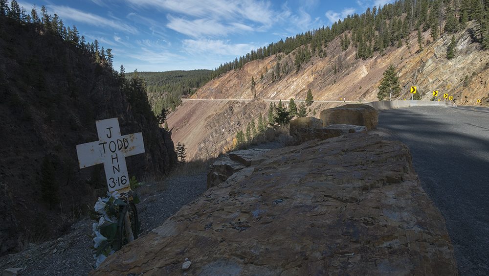
I see the crosses as soon as I enter the state on Highway 212 and they follow me as I drive across the southern portion of Montana - a cross for every vehicular death in the state. Montana has the highest rate of drunk driving deaths in the country and is among the highest in rate of highway deaths per capita. The same endless highways that are easing me to a clearer place also serve to lull people to sleep, or bore them to drink, or cause road hypnosis. Hitting a moose or elk at 75 mph, or 90, would likely be a quick killer, too. The cross program is administered by American Legion chapters around the state and was started over fifty years ago in an effort to get people to slow down and pay attention. I do.
Capps Taxidermy, Anaconda, Montana
Last Stand Hill, Little Bighorn Battlefield Memorial, Hardin, Montana
Little Bighorn Valley from Last Stand Hill, Little Bighorn Battlefield Memorial, Hardin, Montana. The markers represent the spots where individual soldiers fell.
Memorial Marker, Custer National Cemetery, Hardin, Montana
As a child, I was steeped in the righteousness of Manifest Destiny. I learned that George Custer and the men of the 7th Calvary were heroes, opening the western territory to development, defending the settlers, and bringing civilization and Christianity to the Indians. What could possibly be wrong with that? Dee Brown's book, Bury My Heart at Wounded Knee, helped me understand Indian Policy for the land and resource grab it was. The genocide our ancestors committed against our Native peoples was the ultimate ending for anyone who stood in the way of this progress. The Lakota, Cheyenne, and Arapaho families - men, women, and children - gathered at Little Big Horn creek were all thought to be hostile by the US government, and the general population, because they refused to sign a "new" treaty ceding the Black Hills to the whites and would not re-locate onto reservations. On June 25, 1876, Custer and his 7th Calvary troopers attacked what was thought to be the largest native encampment anyone had ever seen, 8,000 people with over 2,000 warriors. The Indians, of course, won that battle, but soon lost the war and their centuries-old way of life.
The Little Big Horn Battlefield Monument has long honored and mythologized the fallen soldiers, their bold, dashing commander, and even their horses. Monuments, plaques, the cemetery, individual markers where the soldiers died began to be erected immediately after the battle. It all speaks to the soldier's heroism and the sanctity of their cause. In the last twenty-five years, the Monument has become more inclusive of Native American points-of-view and begun to relate the legitimacy of the Native defense of their homeland and their way of life. A few markers representing the spots where individual warriors fell during the fighting have been added recently. And in 1991, the US government authorized an Indian Memorial at the sight and commissioned a sculpture by Native artist, Colleen Cutschall. Inside the visitor center, a film gives a generally fair assessment of the time period, the battle itself, and the aftermath.
As I was leaving the film, I overheard a middle-aged white woman remark, "I don't understand why they would want to live like that anyway."
Grave Marker for 7th Calvary Horse Cemetery, Little Big Horn National Monument, Hardin, Montana
This Crow Indian man was a scout for the 7th Cavalry. It is easy to ask, "How could he fight for the white man against other Indians?" Even his English name speaks to the tone of his relationship. Yet, from the point of view of the Crow people, the Europeans had already won the war, and the west, and it was better to assimilate than fight a losing battle. Also, the Crow and the Sioux had been arch enemies for centuries. Joining the US Army not only assured the Crow better treatment from the whites, but also offered the opportunity to kill their traditional nemesis.
Grave Marker, Custer National Cemetery, Hardin, Montana
Memorial Marker for Lakota Warrior, Little Bighorn Battlefield Memorial, Hardin, Montana
Indian Memorial themed Peace Through Unity, Little Bighorn Battlefield Memorial, Hardin, Montana
What to say about this place? Anything I say is quite easy and almost trite from the safety of 140 years and the security of my mountain land that was once part of the Cherokee nation before the Trail of Tears fixed that. I'm skeptical. But many brave men on both sides died here. I try to put myself in the place of one of the many recent European immigrants who fought and died on this hill, perhaps one of the Italians who arrived thirty-five years earlier than my grandfather. What was that man thinking as he faced thousands of determined, angry, and very hostile Indians defending their families and land? I wonder if he understood in his heart why he was going to die that day? Why in that place, far away from his home, fighting a people he knew nothing about, was he going to die a very violent death? Did he see he was just a very small piece in a much larger cultural struggle? I wonder if he saw the irony in all of it, but especially in his journey? Arriving from the Old Country as one of the oppressed, only to go to work for the oppressor in the New World, and this is what it got him.
If nothing else, as the soldiers were being overwhelmed, I'm sure he was saying, Oh Shit! I should have stayed home.
Indian Memorial themed Peace Through Unity, Little Bighorn Battlefield Memorial, Hardin, Montana
Western South Dakota
Mt. Rushmore, South Dakota
I'm prepared to not like Mt. Rushmore. It is such an obvious affront to Native peoples who have long considered the Black Hills their Holy Land - The Heart of Everything That Is. Those four giant granite heads, the Great White Fathers, lording it over land that was deeded to the Sioux and Cheyenne in perpetuity in 1868 in the Fort Laramie Treaty that barred all white settlers and travelers. In 1874, George Armstrong Custer led a 1,000-man expeditionary force into the region, which included miners who discovered gold. Congress tried to buy the Black Hills from the Sioux who refused, at which point the government just took the land and demanded the Sioux move onto the reservation. This, of course, led directly to the Great Sioux War and the Battle of the Little Big Horn in 1876, and the eventual end of the Plains Indian nomadic way of life.
Despite this history, and the detritus that comes with an obvious tourist destination, I'm moved by the sculpture. Its power and grace, its size and beauty. The technical proficiency of it. According to the sculptor, Gutzon Borglum, the idea was to "place there, carved high, as close to heaven as we can, the words of our leaders, their faces, to show posterity what manner of men they were." It has also been a boon for tourism and brings in over three million visitors a year to the area.
Mt. Rushmore, South Dakota
I set up camp at Wind Cave, the place of the Lakota Emergence. The campground is out in the prairie. It's quiet with not so many other campers until a family from Minnesota arrive in a yuge motorhome. They spend little time outside, choosing to run their generator and watch movies. The campground has a bathroom, which is nice. The first thing I see, I'm sure by design, is a poster reminding me I am in mountain lion territory and if I should see one I should act big. I truly hope I don't have to put my acting skills to use.
Wind Cave Campground, South Dakota
The Crazy Horse Memorial has been high on my list for this trip and I've been saying, only half facetiously, that I was hoping Crazy Horse might have answers for my life angst. My friend Michael Carlebach, another photographer, who visited the area earlier in the summer assured me I would get no answers if my questions were photographic as there was no good angle to picture the sculpture. He was right about that. Another friend, an old elementary school classmate who I've recently heard from, Donna Xander, didn't think I'd find spiritual answers either, primarily because of the feel of the place. She was right, too, it wasn't conducive to any kind of meditation.
Crazy Horse Memorial, South Dakota
I pay four dollars for a bus ride to the base of the mountain. To get to the top to have a close-up selfie with Crazy Horse costs $125. The bus driver says there are ten or twelve full-time, year round workers on the mountain. He said, because of the iron content in the granite, the workers lose more time to lightning storms than snow and ice. The sculpture was begun in 1948, the year after I was born, and when asked, the driver says he thinks it will easily be another seventy-five or a hundred years before it's completed. The finished project will be four times the size of Mt. Rushmore. The project has not been without controversy, primarily from Native groups who believe the land was for meditation and enjoyment, and not to be carved into symbols. I think most would have just as soon left the mountain as it was.
1/34th Scale Model of the Crazy Horse Memorial, South Dakota
After Crazy Horse had surrendered and gone to the reservation, not long before he was murdered while in custody, he was asked where his lands were now in the face of his surrender? He, now famously, replied, My Lands Are Where My Dead Lie Buried.
Is this the same question I've been asking myself - in the face of change, where is my place? With my ancestors? Where I've invested my time and energy? Or is it someplace completely new?Maybe Crazy Horse does have answers.
Custer, South Dakota
Wyoming
I make my way over to Devils Tower in Wyoming, another Native sacred space, now a National Monument. Actually, it is the country's first National Monument, established in 1906 by Theodore Roosevelt under the new Antiquities Act. It's crowded with people around the entrance - families with running, yelling children, elders moving slowly with walking sticks and daypacks, and climbers (over 5,000 a year) scaling the 865-foot face. Most everyone gives only cursory acknowledgement to this force of nature. I take the longer of the trails around what many Native people called Bear 's Lodge and it's there I find a degree of silence and a clearer sense of place. A pine forest that gives way to native prairie, a light breeze, color in the forest, the monolith looms above me wherever I walk. Its presence is dominant, and after a time, I expect it to be there. missing it when it falls from sight around a bend or behind a hillock.
Devils Tower National Monument, Wyoming
Devils Tower National Monument, Wyoming
The Circle of Sacred Smoke, Devils Tower National Monument, Wyoming
It seems to be the same in many of these sacred spaces - there are quite simply too many people to find any degree of solace. And those people have such diverse ideas of how these places should be preserved and made available to the public. In the campground, a group of boy scouts arrive at dark and set up their camp, complete with mobile kitchen. They're loud - big talking and big laughing people. It's cold so I'm in bed early.
I wake thinking of Kate. Her travels over the last few years have been an inspiration for me. How fortunate I am to be able to take this needed trip. To be slow, empty of sound, and not overwhelmed by the day-to-day.
Devils Tower National Monument, Wyoming
Badlands National Park, Interior, South Dakota
I get to the Badlands campground mid-afternoon. I haven't camped in many years and want to give myself time to set up. As I drive around the site looking for a spot, I notice many collapsed tents and others being dismantled by their owners. Even the people in campers and trailers are battening down the hatches. The wind has grown fierce and constant, a steady 50 mph with 60-70 mph gusts. It's a hot, dry wind blowing in a clear blue sky, a warm day in mid October. People say it's unusual for South Dakota and wonder why it isn't snowing. I wonder what's behind that wind.
I somehow get the tent set up behind a slight rise in the prairie. Three stakes at every corner and an absolute struggle, a wrestling match, to get the poles in place. The tent bows with every gust, but stays in place. I feel I've accomplished something where those other young campers couldn't. Yet another victory for old age. I rig a tarp to keep my stove lit and make a cup of french press coffee first and then a meal. The sun is gone by now and the warm temperatures of daylight have vanished. I read for awhile, write for awhile, just sit for awhile, finally accepting the inevitability of the sleeping bag for warmth.
Badlands National Park, Interior, South Dakota
My mind is quiet and content as I lay awake in my tent. Leslie asked me earlier in the day if I was missing home yet. No. Lonely? Some. But I understand "lonely" as part of the trip, the process. Kind of want to see if I can stand myself. To spend time alone. But tonight the story is the wind. Howling, shrieking, threatening to break tent poles, gusts that lay the tent to the ground with me in it. Reading impossible. I consider moving to the car, but don't. I lay awake, belly up, the stars bright above me, letting the wind have its way. I've smoked some and I'm easy, expansive. I think, The Wind. To experience this wind. This is why I'm here.
Badlands National Park, Interior, South Dakota
I drive around the park the next day, stopping at turn offs and walking . There are many tourists in the park who also stop, but most get out of their cars, make a picture, a selfie, and leave. I have read the literature and have some understanding of the formation of the Badlands - what happened geologically for it to look as it does. But even with that knowledge, the landscape is like nothing I've seen before and while superlatives come to mind - forbidding, mystical, etherial, harsh - words can't begin to convey the place. Nor can photographs. Brutally hot in summer, brutally cold in winter. But people live here, and have for over 11,000 years. Mammoth hunters, nomadic buffalo hunters, homesteaders and pioneers. In my tent last night, I thought of us campers as modern-day nomads - hauling our lives with us, slowly across the landscape, capturing images and feelings if not buffalo and elk.
Badlands National Park, Western South Dakota
Western South Dakota
Town Sculpture, Scenic, South Dakota
Scenic, South Dakota
Western South Dakota
I've wanted to take a northern route across the country for a number of years, through parts of the upper midwest, fly-over country. The thought of miles and miles of corn and wheat, deserted two-lane roads, and harsh, unyielding, angular light appealed. It wasn't total isolation I wanted, but rather, a certain removal from my world - a world I sometimes think I know too well.
I head south from Sioux Falls and then west on Highway 18. It's what I want. I drive ten miles an hour below the speed limit. Just looking. Barely stopping to make any photographs. No music. Just looking. Breathing. For a brief moment, surrounded by corn and nothing else as far as I can see, I think ah, corn syrup. The Missouri River and onto the Rosebud Sioux Reservation. I stop at the Crossroads Inn in Martin for the night. There's still light left in the day, but the Crossroads is the only place within an hour in any direction and I don't want to be driving after dark. I check in, and go out, to Merrimon, Nebraska, on a mission to find the Sand Bar. Cedric is concerned it has closed since we can find no mention of it online. But it's there where he said it should be. I go in and order a Coke, which garners looks from the two guys at the bar watching a football game on the tv. The bar is dark and decorated with all things western - rodeo stuff, animal heads, posters. No one is talking, certainly not to me, so I finish my Coke and leave. There is nothing subtle about the light as I drive back to the motel. The unbroken horizon offers no respite. Welder's goggles, maybe. The next morning I have breakfast at the local VFW hall in Martin. They welcome everyone and $7 bought a good meal of eggs, sausage, biscuits, potatoes and coffee.
The Sand Bar, Merriman, Nebraska
Across the road from the Sand Bar, Merriman, Nebraska
Bowring Ranch, Merriman, Nebraska
As I drive to Wounded Knee on the Pine Ridge Sioux Reservation, I'm reminded of a time forty-five years ago. I had been granted Conscientious Objector status to the draft and needed to do two years of alternative service. I was working as a counselor in a halfway house for boys in Maryland at the time and through work I met a Pastor in Scottsbluff, Nebraska, who operated a similar facility on the Pine Ridge Reservation in South Dakota. He thought it might be a good fit for my service requirment. I drove out in February of 1971. I didn't take the job or stay long. It was desolate and bitter cold, the wind strong and unrelenting. One of the poorest communities in the country. I knew I wouldn't have lasted very long in that environment.
That was also a time of growing unrest among many Native American tribes that saw the rise of the American Indian Movement (AIM). The unrest culminated in the takeover of the township of Wounded Knee on the Lakota Sioux Reservation at Pine Ridge by AIM leaders and traditionalists among the Lakota. It lasted seventy-one days and finally ended when government officials shut off power to the town in February, as well as, phone and all traffic in and out of the town. They starved them out.
Wounded Knee, South Dakota
Wounded Knee was chosen by AIM leaders as the site for their protest because of its symbolic value as the site of one darkest spots on our altogether murderous collective history with Native peoples. OnDecember 29, 1890, fourteen years after the Battle of the Little Big Horn, the US Seventh Calvary massacred over 250 Lakota men, women, and children who were being moved to the reservation. It is widely considered to represent the end of the centuries-old Indian Wars.
Victims Memorial, Wounded Knee Cemetery, South Dakota
Vietnam Veteran, Wounded Knee Cemetery, South Dakota
To visit Wounded Knee today is to understand that our mistreatment and disregard of Native Americans continues unabated. It remains a very poor place with few opportunities for work. Trailers are spread out on the valley floor, just next to the massacre site. In the two hours I was there, I was approached by a dozen different people selling dreamcatchers and sweetgrass, all of them approaching me with the same handwritten note explaining their need. My dreamcatcher still hangs in my car.
It's important to be here. Why? Do I even know? Penance. Guilt. Honor. Recognition. Understanding. At the cemetery you feel the power of this sacred place. Walking among the graves is a walk through history and personal tragedy, one most Americans choose to forget, if they know of it at all. It's a clear, warm day, the wind is picking up, blowing dust and sagebrush over the prairie - no sign of an impending blizzard like the one that hit Wounded Knee the day after the 1890 massacre, freezing all the bodies hard in place.
Pine Ridge, South Dakota
Native American Community Center, Martin, South Dakota
The mural speaks to a desire for unity and peace. And Native Americans have long been among the most patriotic of Americans, serving courageously, and in great numbers, in all of our nation's conflicts. I struggle to understand these hopes and heroic acts in the context of my own refusal to serve in the military for reasons of conscience. How could you have faith in, and fight for, the government that stripped you of your way of life, stole your land, and continues to oppress you? I don't know how one does that, but I think the answer may lie somewhere in Cedric's word, surrender. Not the "giving up" kind of surrender, but rather, surrender as acceptance or resignation.